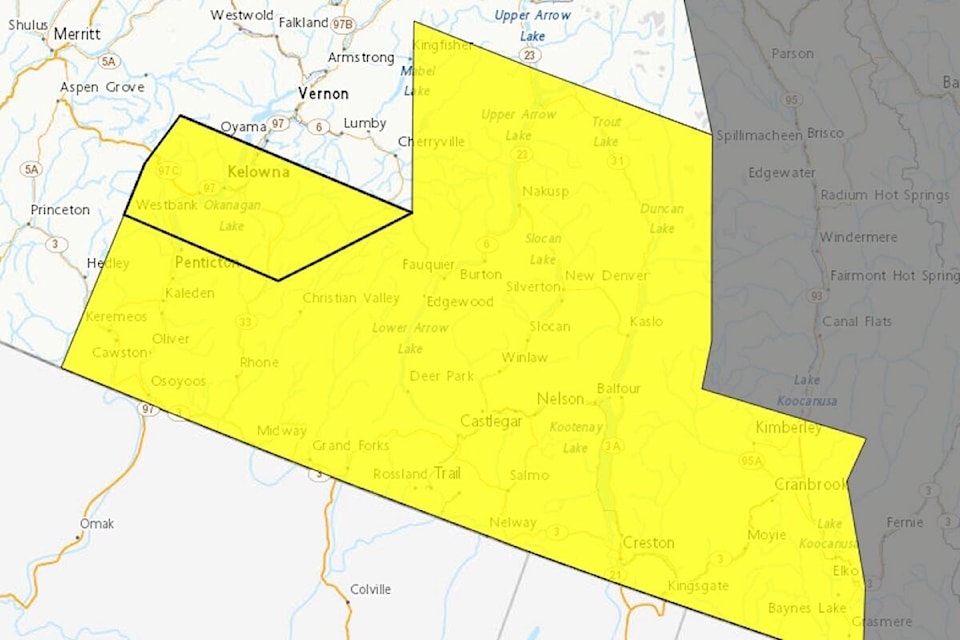
A severe thunderstorm watch has been issued for the South and Central Okanagan and the Upper and Lower Arrow Lake area.
According to Environment Canada, conditions are favourable for the development of severe thunderstorms that may be capable of producing strong wind gusts and heavy rain.
The watch also affects areas north of Kelowna through Cherryville and Mable Lake, over to Nakusp and south to Creston, Cranbrook and Trail.
Severe thunderstorm watches are issued when atmospheric conditions are favourable for the development of thunderstorms that could produce one or more of the following: large hail, damaging winds, and torrential rainfall.
Environment Canada warns heavy downpours can cause flash floods and water pooling on roads.
Remember when thunder roars, go indoors.
READ MORE: Vehicle rollover on Highway 97 near Crystal Waters
